- Close
TOMORROW'S CITIES PHD'S
Within our Hub, several PhD project have been undertaken that delve into themes as diverse as the impact of disasters on children’s wellbeing, the propagation of seismic waves through the earth’s crust, and the issue of digital injustice in cities across the Global South. Despite their varied focuses, these projects all share a common goal: contributing to Tomorrow’s Cities mission of reducing disaster risk for urban poor communities.
These are the stories of the people behind the research and how their work contributes to that objective.
Mark Kuyo Ojal
University College London, Institute of Risk and Disaster ReductionSupervisors: Mark Pelling, Cassidy Johnson
My PHD in Tomorrow's Cities
UNDERSTANDING DECISION-MAKING PROCESSES AND INSTITUTIONAL DYNAMICS FOR DISASTER RISK REDUCTIONUrban growth in Sub-Saharan cities demands quick action to integrate adaptation and resilience into planning, especially for marginalized groups.
Yet, in Sub-Saharan Africa limited knowledge; financial and institutional incapacities; and weak governance are hindering this change and creating obstacles to reduce and break cycles of risk accumulation.
My research dives into how relationships between institutions and other urban actors affect disaster risks in poor areas.
“I am an adventure junkie and a passionate 4×4 enthusiast. I love to visit new places and to soak in nature. I have a keen interest in nature conservation and restoring landscapes in rural Kenya. Despite my love for the wild, I delight in designing streets and find joy in street experiments and that’s why I work in inclusive urban development.
Cities are growing at unprecedent rates and in Sub-Saharan Africa that’s a very clear reality. This means that we have a short window to weave transformative adaptation and climate resilience into urban planning. By seizing this opportunity, we can tackle development and risk issues simultaneously. Of course, this change must also prioritize marginalized communities and that can only be achieved by inclusive decision-making processes.
However, in Sub-Saharan Africa limited knowledge; financial and institutional incapacities; and weak governance at the city level to plan and manage rapid urban growth, reduce risk and break cycles of risk accumulation, are hindering this change.
My work aims to understand how relationships between institutions and actors involved in urban development planning and decision-making contribute to disaster risks in urban poor settlements. It seeks to achieve this by unpacking the processes of urban change, especially the ways in which urban development decision-making is negotiated, how institutions change, interact with organisations, agency and other institutions.
Being a part of Tomorrow’s Cities has offered me a great opportunity to learn and have peer support. The breadth of research across the different disciplines is especially appealing. Additionally, networking with a diverse group of Ph.D. students working at the nexus of urbanism and disaster risks across nine cities is rewarding.”
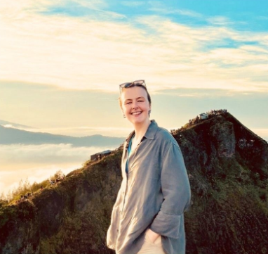
Harriet E. Thompson
King’s College London, Department of GeographySupervisors: Faith E. Taylor, Bruce D. Malamud, Joel C. Gill, Robert Šakić Trogrlić and Melanie Duncan
My PHD in Tomorrow's Cities
BLENDING INFORMATION SOURCES FOR DISASTER RISK REDUCTION IN KATHMANDU, NEPAL.People who are affected by natural hazards, and practitioners working with them, require holistic knowledge of hazardscapes to prepare and respond effectively.
My research considers how we can use blended sources of information, such as disaster databases, academic and grey literature, newspaper articles, interviews and focus group discussions, to supplement our understanding of natural hazard impacts, particularly on more “marginalised” groups.
“Gathering nuanced information about natural hazard events and their impacts, particularly in more data poor regions, remains a significant challenge. People who are affected by natural hazards, and practitioners working with them, require holistic knowledge of hazardscapes to prepare and respond effectively.
My research considers how we can use blended sources of information, such as disaster databases, academic and grey literature, newspaper articles, interviews and focus group discussions, to supplement our understanding of natural hazard impacts, particularly on more “marginalised” groups. We apply this interdisciplinary methodology to the context of Kathmandu Valley, Nepal, where rapid urbanisation and high exposure to multi-hazards exacerbate the impacts of hazard events.
The driving force behind Tomorrow’s Cities presents a time-limited opportunity to reduce disaster risk across the hub cities. As PhD researchers working within the broader hub team, I believe that we all aspire to contribute towards delivering sustainable impact in a real-world context. For me, the hub offers the platform to work in a team of practitioners united by their commitment to equitable collaboration. I aspire that my research can emphasise the value of interdisciplinary approaches in the field of disaster risk and support continued communication across sectors.
Like many of the hub’s PhD researchers, I find joy in spending time in nature – especially the North York Moors and Yorkshire Dales National Parks – and trying great food. In my spare time, I am inspired by the communities that I volunteer with and rare conversations with strangers on the Tube (London Underground). Most of all, I love having a good laugh with my family and friends!”
Wenlan Zhang
University College London, Centre for Advanced Spatial AnalysisSupervisors: Chen Zhong, Mark Pelling, Faith Taylor
My PHD in Tomorrow's Cities
ADDRESSING DIGITAL INEQUALITY IN DISASTER RESPONSE: INSIGHTS FROM NAIROBI.Leveraging mobile phone data offers crucial insights for disaster response and risk reduction. However, its reliability, especially in representing marginalized populations, remains debated.
Focusing on Nairobi, my research combines various data sources to reveal how big data often overlooks those in informal settlements, leading to biased disaster policies. My work aims to quantify and mitigate digital inequality, engaging local stakeholders to develop inclusive strategies.
“Leveraging data from mobile phones can provide valuable insights into disaster-affected areas, aid in emergency response efforts, and inform decision-making for disaster management and risk reduction. For floods, for instance, this can be done by collecting device’s location data which allows authorities to map the extent of the flood. We can also ask users to report their location and provide information about flood conditions in real-time or gather call data records to understand population movements and identify areas of high activity or congestion. However, the reliability and feasibility of this data is still controversial, the most important of which is whether it can represent the whole population with justice, especially in the Global South where access to technology is socially unequal.
Centred on Nairobi, my research combines satellite images, nighttime light images, building data, tweets, and street view pictures to illuminate how big data, such as mobile phone data, fails to present an accurate picture of society by excluding the digitally invisible—those living in the informal settlements of the city. Such bias can result in unfair disaster risk reduction policies that rely on this data as a source.
My research aims to measure and tackle digital inequality, including discrepancies in access to technology and digital services, within urban areas. The project aims to identify strategies to mitigate these inequalities. This could involve improving algorithms used in digital systems to ensure fair and equitable outcomes, as well as engaging local communities in participatory mapping exercises to better understand their needs and challenges.
I will also interview various local stakeholders, including government officials, community leaders, and technology experts, to gather their insights and perspectives. Based on these findings, we will produce policy recommendations to address digital injustice and promote more inclusive and equitable access to digital technologies in Nairobi and similar cities in the Global South.
I joined Tomorrow’s Cities for two reasons: My PhD research aligns well with the core mission of the Hub, and I’m excited to connect with fellow researchers who share my interests in data-driven environmental conservation and addressing inequality.”
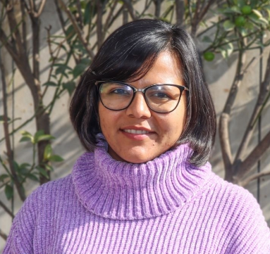
Rachana Upadhyaya
University of Bristol School of Sociology, Politics and the International StudiesSupervisors: Ryerson Christie and Ashley Dodsworth
My PHD in Tomorrow's Cities
CHALLENGING THE NORM IN DISASTER RISK REDUCTION STUDIES.When in 2018, the Hanumante River flooded parts of my neighbourhood in Bhaktapur in Nepal, following the incessant rainfall overnight, it changed my perspective forever.
In my research, I conducted an eight-month ethnographic field study in Kathmandu Valley’s largest squatter settlement. Challenging the conventional division between natural hazards and social disasters my work explores how Kathmandu’s informal settlements have transformed into complex socio-environmental spaces, challenging traditional planning frameworks and land ownership concepts.
“When in 2018, the Hanumante River flooded parts of my neighbourhood in Bhaktapur in Nepal, following the incessant rainfall overnight, it changed my perspective forever. Seeing children floating in the water on Styrofoam made me realize how disasters affect people differently. As most of the area was flooded, my house was spared only because we were lucky enough to live in an elevated area. That event made me interested in understanding how different social contexts affect the outcomes of disasters for individuals.
Joining Tomorrow’s Cities in 2019 the focus of my work was slightly different; however, it did open up an avenue of research area – thinking of possible futures. Starting my PhD in 2021, I naturally gravitated towards urban poverty, floods, and future possibilities, inspired by my work with the Hub.
In my research, I conducted an eight-month ethnographic field study in Kathmandu Valley’s largest squatter settlement. This involved 60 interviews with residents, urban planners, DRR experts, land historians, and land rights advocates. The research begins by questioning the conventional division between natural hazards and social disasters in disaster studies and explores how Kathmandu’s informal settlements have transformed into complex socio-environmental spaces, challenging traditional planning frameworks and land ownership concepts. This work tries to understand how informal settlements in Kathmandu Valley are shaped by the interplay of different factors, such as socio-economic conditions, political dynamics, environmental factors, and cultural practices. This perspective allows for a nuanced analysis of the complexities involved in the formation and transformation of these urban spaces.
Before my PhD, I worked as a development worker for around 8 years. As a part of my job, I got the opportunity to travel around Nepal mostly to remote and rural parts of the country. As a development worker and now researcher, I have always been conscious about who we write about, what we write and how we write. Often, our subjects lack access to the written word, prompting me to favour storytelling and narrative approaches. I am very passionate about making academic writing accessible and fun to read!”
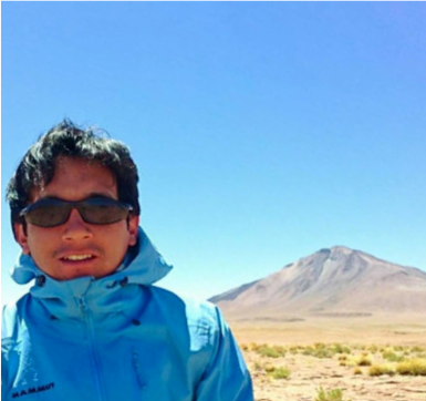
Francisco J. Vasconez
University of Bristol, School of Earth Sciences / Instituto Geofísico, Ecuador.Supervisors: Jeremy Phillips
My PHD in Tomorrow's Cities
STUDYING VOLCANIC DEBRIS FLOWS IN ECUADORWhen in 2013 I climbed the Cotopaxi the second highest summit in Ecuador, my home country, I was so amazed at the incredible eruptions of the El Reventador and Sangay, that I decided to become a volcanologist.
Now, as a distance-learning PhD student at the University of Bristol, I study volcanic-associated debris flows, also known as lahars, using both field observations and computer-based simulations. My research focuses on the Cayambe and the Cotopaxi volcanoes.
“When in 2013 I climbed the Cotopaxi the second highest summit in Ecuador, my home country, I was so amazed at the incredible eruptions of the El Reventador and Sangay, that I decided to become a volcanologist.
Now, as a distance-learning PhD student at the University of Bristol, I study volcanic-associated debris flows, also known as lahars, using both field observations and computer-based simulations. My research focuses on the Cayambe and the Cotopaxi volcanoes. We found that the lahars in these volcanoes are not all eruption related and highlighted the importance of resolution when modelling long distance gravity flows such as lahars.
I believe in a multidisciplinary approach to research where various fields and perspectives come together to make a positive impact in society. With that in mind, I try to assimilate the best practices from other disciplines and incorporate them into my daily work. A good example of that, is the flipbook we created to help isolated communities in Ecuador to understand and visualise how lahars form.”
Ashrika Sharma
University of Edinburgh, School of GeosciencesSupervisors: Kate Donovan, Sukanya Krishnamurthy, Maggie Creed
My PHD in Tomorrow's Cities
PEOPLE AT THE CENTRE OF DRR POLICYAfter completing my masters in Disaster Preparedness, I found myself regularly in the field, engaging with vulnerable communities. Yet, despite my efforts, I felt my role accounted to nothing more than documenting their struggles in reports that seemed to disappear into bureaucratic oblivion.
Now, my PhD looks into the barriers to public participation in DRR and sheds light on the mechanisms that perpetuate and reinforces them. Understanding this is crucial to Tomorrow’s Cities mission to put people at the centre of DRR decision making processes.
“Born in Kathmandu, Nepal, I embarked on an engineering journey, later pursuing a master’s in a similar technical field. Throughout my career, be it as an engineer or DRR practitioner, I’ve always gravitated towards roles that felt meaningful to me.
After completing my masters in Disaster Preparedness, Mitigation and Management in 2018, I was working in Nepal in different avenues of Disaster Risk Reduction (DRR) for quite some time. During that period, I found myself constantly in the field, engaging with vulnerable communities. Yet, despite my presence and efforts to assist them, I felt my work was futile. Each interaction I would have with communities, left me with profound sadness, realising that my role accounted to nothing more than documenting the struggles and vulnerabilities of the communities in reports that seemed to disappear into bureaucratic oblivion. Then, in 2019 Tomorrow Cities started and I felt that there was a vision to change that through a scholarly movement that was dedicated to bringing communities to the forefront of DRR decision making.
My PhD journey over the past 4 years has been around that, to understand the theory and the practice of public participation in DRR decision making. When I started my PhD, I wanted to come up with a framework for meaningful public participation in DRR. However, after four years, I’ve learnt that reducing participation to a framework is overly simplistic.
In my research, I critique existing frameworks, participatory practices and question their effectiveness to reduce vulnerability. Drawing from a case study in Nepal, my research highlights some of the barriers of public participation in DRR. In addition, I shed light on the mechanisms that perpetuate and reinforces the barriers. Understanding these barriers is crucial to TC’s mission to put people at the centre of the DRR decision-making process.
Reflecting on my PhD journey, I see it as an exploration to uncover the social scientist within. In its early stages, I found myself using terms like “deliberative democracy,” “positionality,” and “intersectionality” surprised and intrigued the engineer in me—and they still do.
When I am not working on my PhD, I spend time cooking and reading. While I appreciate the outdoors, I prefer to enjoy it without the intense physical activity, therefore I enjoy relaxed long walks. I also enjoy dancing.”
Prakash Pokhrel
University of Edinburgh, School of GeosciencesSupervisors: Hugh Sinclair, Simon Mudd and Mikael Attal
My PHD in Tomorrow's Cities
BASIN SUBSIDENCE AND FLOOD HAZARD MODELLING IN NEPALBorn in the majestic Himalayas, I’ve always been captivated by its beauty and intrigued by the forces shaping it. But nature isn’t always gentle. From landslides to the occasional earthquake, this region has seen it all. These experiences sparked my interest in learning about our planet’s inner works.
My research provides insights on the shrinking of Kathmandu’s catchment area caused by subsidence and related to sediment thickness. This information is crucial to improve flood risk models in the region.
“Born in the majestic Himalayas, I’ve always been captivated by its beauty and intrigued by the forces shaping it. But let’s be honest, nature isn’t always gentle. From landslides and floods to the occasional earthquake, my region has seen it all. These experiences sparked my interest in learning about our planet’s inner works.
Before I joined the Tomorrow’s Cities project, I was working on a similar project but on a national level. I was eager to work on Disaster Risk Management in Nepal within the broader international scientific community, and the opportunity came through the Tomorrow’s Cities Kathmandu Hub.
In my research, I explore the long-term geological processes, comparing them with what’s happening today. Specifically, my PhD project focuses on understanding how the Kathmandu valley evolved from a large river valley to a lake and eventually to one of the world’s most densely populated cities. To study this, I use various tools like geomorphic features, topographic analysis, and cosmogenic nuclides. My research provides insight on the shrinking of Kathmandu’s basin catchment area and what impact that has on the local watershed. The subsidence rate is notably higher in areas with thick sediment, while there is little to no land subsidence in regions with thin sediment. This poses a risk of infrastructure damage (as seen in other cities), and significantly impacts the flood inundation maps prepared for the basin. In brief, incorporating the land subsidence rate into the flood risk model, recognizing it as one of the multiple hazards in the basin, aligns with the mission of the Hub in the Kathmandu Basin.”
Saraswati Thapa
University of Edinburgh, School of GeosciencesSupervisors: Hugh Sinclair, Maggie Creed, Simon Mudd, Mikeal Attal and Bhola Ghimre
My PHD in Tomorrow's Cities
FLOOD HAZARD MODELLING IN NEPALUrban expansion into floodplain areas – known as floodplain encroachment- and climate change are altering sediment dynamics and increasing flood risk.
Traditional flood hazard models frequently overlooks sediment movement in rivers, resulting in flawed models. My research investigates the impact of sediment supply coming from both natural sources and human activities on flooding in the Nakkhu River in Kathmandu Valley to improve forecasting and reduce disaster-risk.
“Life’s too short to explore every facet alone; so, I believe that hearing others’ experiences broadens our perspective. In that sense, giving voice to the most disadvantaged and to a diverse pool of stakeholders is one of the most interesting aspects I find in Tomorrow’s Cities.
The rapidly increasing urban population, particularly in the Global South countries, is leading to floodplain encroachment (the occupation of the low-lying areas adjacent to rivers and streams that are prone to flooding by buildings and other infrastructure). This and climate change is altering sediment dynamics and increasing flood risk. However, traditional flood hazard modelling frequently overlooks sediment movement in rivers, resulting in flawed models, particularly in rivers with high sediment loads.
Aiming to bridge this gap and enhance flood models, thereby improving flood risk assessment, my research investigates the impact of sediment supply coming from both natural sources and human activities on flooding in the Nakkhu River in Kathmandu Valley. Additionally, it assesses how the construction of river structures, such as embankments, alters sediment transport, river morphology, channel capacity, and flood inundation. I employ a blend of advanced numerical simulations, field observations, and satellite data.”
Camilo Zapata
University of Bristol, School of Civil, Aerospace and Design EngineeringSupervisors: Liz Holcombe and Paul Vardanega
My PHD in Tomorrow's Cities
LANDSLIDE HAZARD ASSESSMENT IN QUITOGrowing up in the Ecuadorian Andes, I was surrounded by active volcanoes, earthquakes, and landslides, which fueled my curiosity about the Earth’s workings. I spent much of my childhood exploring the outdoors, cycling, and trekking through the mountains.
This passion led me to study geology and later develop an interest in disaster risk management, particularly for impoverished communities in high-risk areas. During my PhD, I’ve focused on landslide hazard assessment, tackling challenges in acquiring diverse data crucial for modeling slope stability and forecasting hazards.
“I was born in the landscapes of the Ecuadorian Andes, where active volcanoes, earthquakes and landslides are a very present reality. That context has strongly influenced my curiosity and, as a child, I was passionate about understanding how the Earth worked but also by the great outdoors where I love to spend time cycling or trekking through the mountains. That led me to studying geology and later to become interested in disaster risk management as a tool for development, especially for poor communities in high-exposure zones.
My primary focus is on landslide hazard assessment, a field that grapples with challenges in acquiring data related to topography, soil composition, geotechnical properties, and dynamic interactions like informal urbanization, vegetation changes, and rainfall. This data is essential for modelling the processes that control slope stability and therefore in forecasting future hazard scenarios. In many cities, such data often exists but scattered and can often include local expert and community knowledge. During my PhD I’ve been working on creating a methodology to collect that dispersed information and organise it in a standardized database that can be used in disaster risk management.
Using drones and other aerial methods, I’ve also been working in developing a physics-based model to study slope stability, examining various factors like soil, terrain, urban growth, and rainfall. This will help us create a new geotechnical database for Quito and contribute to investigate the drivers of landslides in Quito.
As part of Tomorrow’s Cities, I’ve also been participating as a trainer on landslide hazards and physical modelling, having had had the pleasure of training the local teams in of the cities that participate in the Hub.”
Himanshu Agrawal
University of Edinburgh, School of GeosciencesSupervisors: Mark Naylor, John McCloskey, Carmine Galasso
My PHD in Tomorrow's Cities
SEISMIC WAVES AND GROUND MOTIONMy personal experiences have shown me the importance of integrating hazard and risk science into urban policy, especially in regions prone to earthquakes like my home country, India.
In my research, I focus on understanding how the properties of the subsurface affect the intensity of ground shaking during earthquakes. This information is crucial for developing effective urban risk models and building codes. I also explore ways to incorporate social factors, such as income levels, into urban development plans to ensure the safety and well-being of all residents, particularly those who are most vulnerable.
“I am a passionate traveller and a comfortable-shoes enthusiast. I love to visit new countries, experience their culture, customs and especially food. My particular interest in reading about various existential philosophies, understanding human evolution and the development of societies, together with the experience from my home country, India, are a great motivation to work with Tomorrow’s Cities.
In India, poor urban development practices, mainly around the seismically active Himalayan ranges, have led to numerous casualties in past earthquake events and continue to pose risk affecting especially the most disadvantaged populations. This situation is common across the Global South. I believe that there’s an urgent need for improved hazard risk models and for risk science to help fostering resilient communities. Tomorrow’s Cities is an ideal platform to achieve this.
One of the most crucial aspects when designing buildings and planning cities in regions exposed to earthquake hazard is ground motion – how the surface responds to the propagation of seismic waves through the Earth’s crust. The propagation of these waves is complex, and it is conditioned by sub-surface rock properties and geometries, resulting in intricate and sometimes unexpected ground motion amplification at the surface. This presents significant challenges when creating ground motion models aimed at providing reliable risk assessments for urban areas.
In my research, I explore how subsurface properties affect ground motion intensities and develop strategies to integrate the most dependable hazard information for effective risk assessment in an urban environment. Additionally, I delve into enhancing risk assessment by interlinking geophysical information with the physical (susceptibility of the built environment) and social factors (Income of the population) to motivate a pro-poor perspective in urban development.”
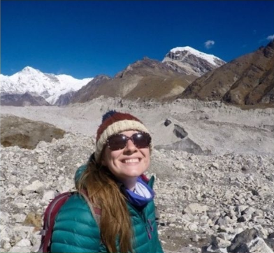
Abby Ewan
University College London - Institute of Risk and Disaster ReductionSupervisors: Mark Pelling, Maria Kett
My PHD in Tomorrow's Cities
DISABILITY AND DISASTER RISK REDUCTIONNepal holds a special place in my heart. It is the place where I became interested in Disaster Risk Reduction and where I met Heinz, a Nepalese mountain dog that I brought back to England.
My research follows people with disabilities through the 2015 Gorkha earthquake and the 2021 Melamchi Flood, studying their recovery. I investigate how responses to these events and resilience efforts affect disability policy, and if the earthquake prompted changes in societal perceptions of disability.
“My research is focused in Nepal, a country that holds a very special place in my heart. It’s where I became interested in disaster risk reduction but also where I met Heinz, a Nepali mountain dog with an exquisite taste for boiled eggs who now lives a luxury life with me in London on a narrowboat. He started following me, I think, because I was carrying some boiled eggs on my backpack, but then he kept going and sleeping outside every lodge I stayed in. I think he adopted me first, so I had no other option than to bring him with me… Today, Heinz is a daily reminder of my adventures in Nepal and of how research can sometimes bring magical and unexpected moments and adventures into our life.
Since then, I became more involved in disaster risk reduction activities in Nepal. For the past two decades, discussions have focused on the vulnerabilities and challenges faced by people with disabilities during extreme events. However, there has been a recent shift that emphasizes the active role that people with disabilities can play as contributors and leaders in risk management and resilience efforts. Despite this shift, people with disabilities remain significantly underrepresented and are rarely involved in the planning and development of resilience strategies and policies. We want to help changing that.
My research aims to understand the experiences of individuals who identify as disabled during the 2015 earthquake and the 2021 Melamchi Flood, as well as their recovery processes. By employing participatory methodologies, we are capturing the voices and experiences of people with disabilities to explore how the response disaster events and the efforts to build resilience have influenced the perception and integration of disability in policies and legislation. Additionally, we aim to investigate whether the earthquake contributed to a change in how society institutionalizes ideas about disability.
As a PhD student affiliated with Tomorrow’s Cities, I’ve been introduced to a significant global network of researchers and practitioners. This affiliation has provided me with the opportunity to engage in a global interdisciplinary hub and gain insights into the complexities and advantages of working within such projects. This understanding is invaluable as I progress in my career as an early-career researcher.”
Rebecca Richardson
Northumbria University, Geography and Environmental SciencesSupervisors: Andrew Collins, John Clayton, Katie Oven
My PHD in Tomorrow's Cities
CHILDREN'S VOICES IN DRR POLICYHelping others, especially those in most need, has been a lifelong commitment for me. I’ve served as an emergency response coordinator during UK terrorist attacks, the Grenfell Tower Fire, and the Calais refugee crisis.
As a PhD researcher in Tomorrow’s Cities, I’ve been working in Nairobi with 36 children aged 10 to 14, and using participatory creative arts-based methods to capture their perspectives about hazards, how their everyday experiences impact their health and wellbeing, and how they communicate the risks they are exposed to.
“Helping others, especially those in most need, has been a lifelong commitment for me. I’ve served as an emergency response coordinator during UK terrorist attacks, the Grenfell Tower Fire, and the Calais refugee crisis. I’ve also volunteered in conservation projects where I worked with orangutans in Borneo, leatherback turtles in Costa Rica, and howler monkeys in Ecuador.
I’m a mother of a 3-year-old boy and, for me, that is the best job in the world! I cannot wait to take him around the world with me on lots of adventures.
In fact my work has been exactly about children and disaster risk reduction (DRR). Having spent numerous years working in international cities with significant populations of urban poor, I’ve witnessed firsthand the inequality and inadequate urban management that lead to daily hardships and harm, particularly for children. As outlined in the United Nations Convention on the Rights of the Child (UNCRC), children have the fundamental right to be heard and valued. However, their perspectives are often overlooked in DRR policies and practices, despite their recognition as a vulnerable group, and of being more affected when disasters occur.
My research takes a child-centred approach and engaged 36 children aged 10 to 14 living in Nairobi’s informal settlements. Using participatory creative arts-based methods, it captures their perspectives about hazards and how their everyday experiences impact their health and wellbeing. It also aims to examine how children communicate about the risks they encounter, identify individuals in their support networks whom they trust to share their concerns, and evaluate the effectiveness of communication pathways for risk information.
This research is fully aligned with the objectives of Tomorrow’s Cities, which focus on comprehending the impact of hazards on the urban poor. It places a strong emphasis on prioritizing the voices of the urban poor in shaping urban policies, with the aim of improving their quality of life.”

