
- Close
Tomorrow's Nakuru
“[The future] Nakuru County has a low carbon, climate resilient economy that sustains the livelihoods of its citizens while contributing to the national development agenda.”
Nakuru County Climate Action PlanSummary
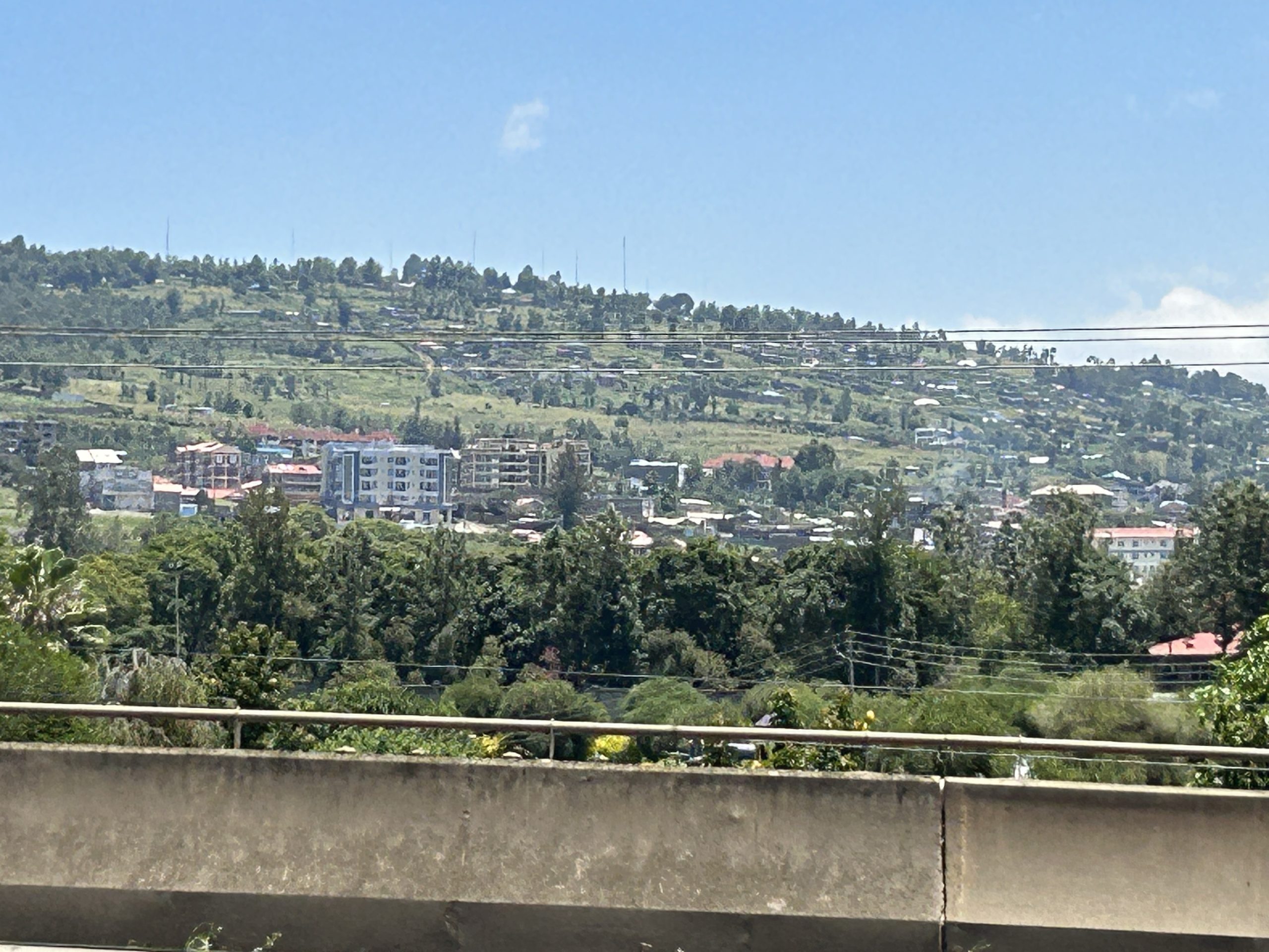
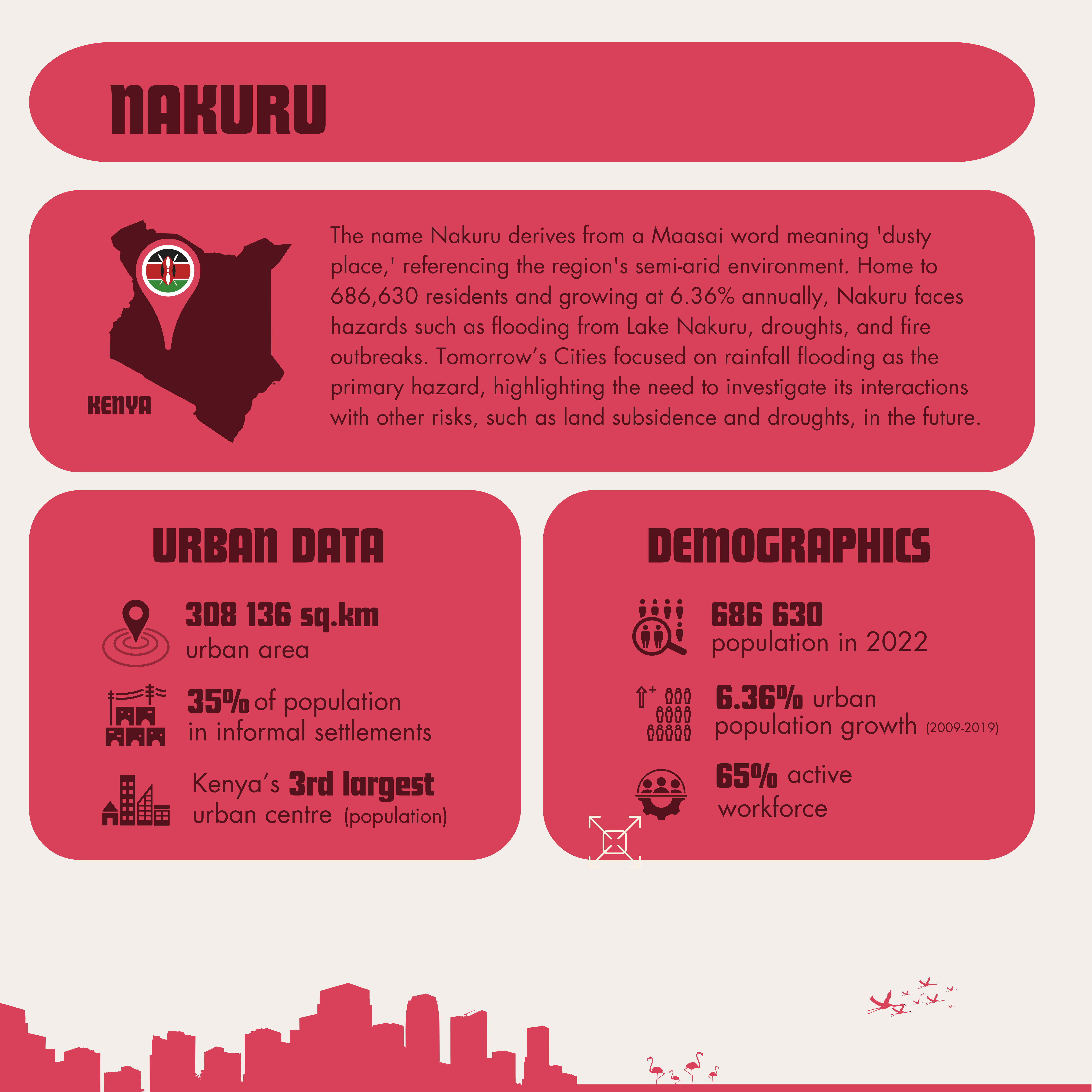
Nakuru, located in the Rift Valley, is Kenya’s third-largest urban area (in terms of population), covering an area of 308 km². Its key features include the Menengai Crater to the north and Lake Nakuru to the south, both of which are linked to disaster risks such as landslides and frequent flooding. With a population of 686,630 in 2022, growing at 6.36% annually, the city is expected to surpass 1 million residents by 2030. Around 35% of the population lives in informal settlements, highlighting significant urban inequalities despite promising development trends. Nakuru faces hazards including rising lake water levels, flooding, droughts, and mobility-related issues like traffic accidents. Despite these challenges, the city has a promising workforce, with 65% of its population in active employment.
Nakuru Challenges
-
1. Natural Hazards
-
Nakuru experiences a moderate climate year-round, characterised by distinct wet and dry seasons. However, climate change is making these seasons increasingly unpredictable, intensifying both extreme dry spells and heavy rainfall events. As the city continues to urbanise, these extremes contribute to flood risks, exacerbated by rapid land-use changes and infrastructure challenges.
Lake Nakuru, a vital local ecosystem, also plays a role in the city’s water dynamics, with rising water levels posing risks to low-lying areas. Additionally, the interactions between flooding and other hazards, such as seismic activity and land subsidence, warrant further investigation to better understand the city’s evolving risk landscape.
-
2. Urban Development
-
Nakuru’s linear development pattern has been shaped by major transportation corridors (Nakuru City, 2022). However, rising lake levels and flood events pose significant challenges to sustainable urban change, potentially leading to settlement displacement, damage to local ecosystems, and disruptions to critical infrastructure, particularly transport networks. Despite these risks, Nakuru retains substantial areas of green and underdeveloped land, with 64.4% of the city’s land publicly owned. This presents valuable opportunities for resilient urban development, enabling strategic planning that integrates climate adaptation, sustainable land use, and ecosystem conservation.
-
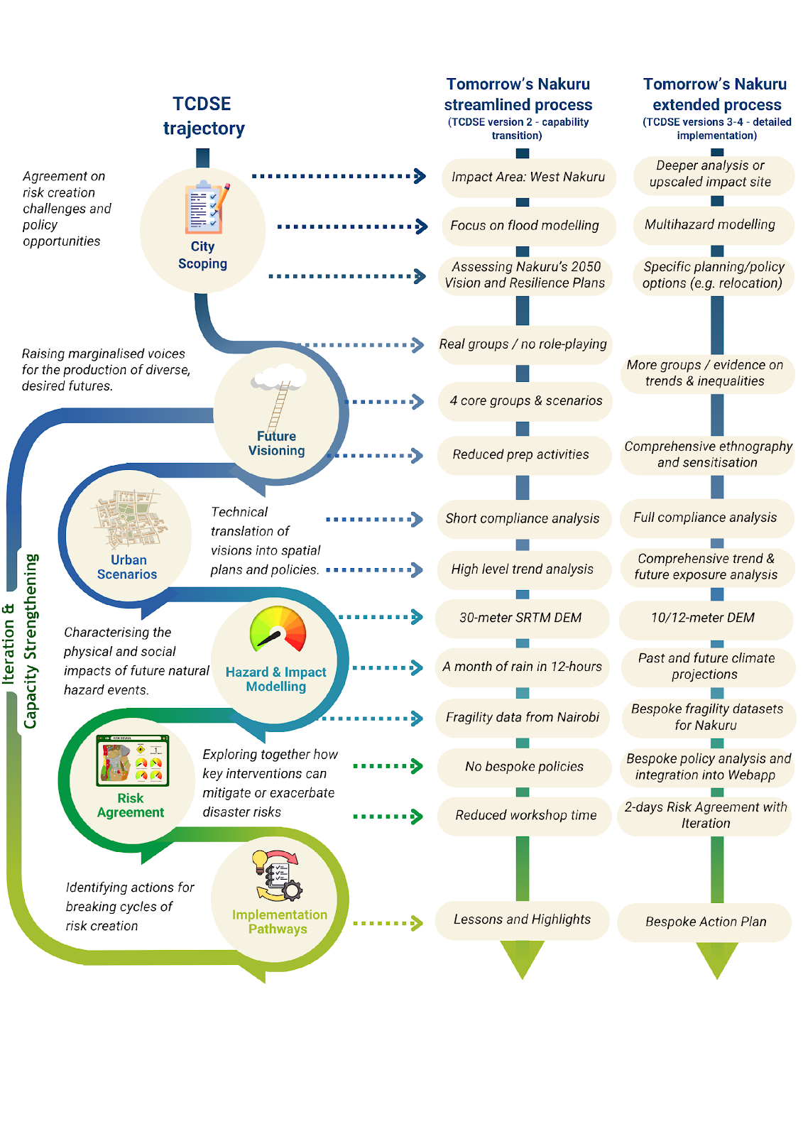
NAKURU’S APPROACH USING THE TCDSE & KEY STAKEHOLDERS
-
Tomorrow’s Cities’ work in Nakuru was developed in partnership with UN-Habitat, Nakuru City County, and the original members of the Tomorrow’s Cities Nairobi Hub, led by the Africa Research and Impact Network (ARIN).
Given Nakuru’s ongoing collaborations with UN-Habitat’s Mobility and Planning groups and its growing focus on flood risk and climate resilience, rainfall-induced flooding was identified as the primary hazard for analysis. The activities were designed to take place within a one-month timeframe, aligning with Tomorrow’s Cities’ ‘Sensitisation’ and ‘Capability Development’ approaches (see Figure below). Engagements also included Tomorrow’s Cities Capacity Strengthening programme.
-
-
USEFUL DOCUMENTS
Social Links


