Technical translation of visions into spatial plans and policies.
The Urban Scenarios component entails a technical translation of Future Visions elaborated by each group, into digital land-use plans and policies. This component innovates by creating a hybrid approach that integrates community-based ideas and science-guided information.
This component consists of three stages:
This stage consists of analysing, digitising and georeferencing community land-use sketches designed by stakeholder groups during Future Visioning workshops. The analysis is done in light of the information that characterises the urban area of interest – natural and built environment, hazards, socio-economic and policy context, as well as the existing urban regulations and trends. The aim is to create an urban plan that honours each group’s visions while remaining technically viable and realistic. In this process digital land use plans depicting dominant land use type (e.g., residential, commercial, industrial) are created.
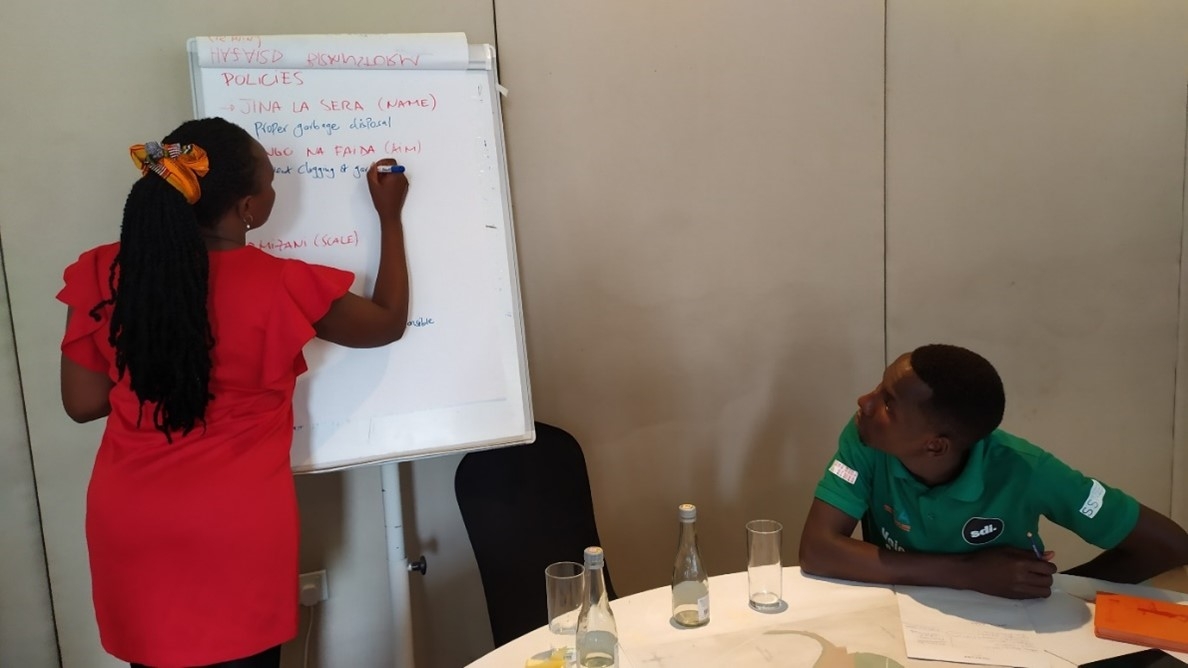
The policy element of this stage encapsulates the selection, adoption, or creation of a range of policies aligned with stakeholders’ aspirations identified in the Future Visioning workshops.
These policies are chosen through expert evaluation and elicitation, and they can be either selected from existing policies or crafted from the ground up to align with the envisioned scenarios. The policies’ scope is defined by two primary considerations: their forward-looking nature and their ability to reduce future disaster risk. Policies can either be spatial orientated, and embedded into the land use plan, or focused on reducing social vulnerability and improving disaster response capacity. For instance, if a community aspires for economic growth, policies related to infrastructure development, job creation, and business incentives may be suggested. On the other hand, if environmental sustainability is a priority, policies related to conservation, renewable energy, and pollution control may be proposed. Despite the diverse aspirations, communities may also find areas of convergence and develop a unique policy approach. Through deliberative processes that foster dialogue and consensus-building, community members may identify shared values and goals that transcend their differences, resulting in the development of a policy option that reflects a collective vision for the community’s future.
While policy themes guide workshops, each measure is tailored to tackle context-specific challenges, later analysed and refined collectively.
Digitised and georeferenced Urban Scenarios based on the sketched designed by the Youth and Women groups in Kibera, Nairobi
The vision of a future Kibera, as envisioned by the women’s group, underscores pressing issues related to road connectivity and access to toilets for women and girls.
In their perspective, a land use plan for 2030 should encompass cultural and religious spaces, such as a local museum.
Priority areas also include zones for waste recycling, alongside provisions for a local school, hospital, and law court.
Digitised and georeferenced Urban Scenarios based on the sketched designed by the Youth and Women groups in Kibera, Nairobi
A key feature of the youth group plan is the vibrant commercial and business district at the core of Kibera. To avoid floods, a green buffer zone is foreseen by the margins of the river. Recreational areas are distributed across the settlement, and there is a significant focus in educational facilities. A cemetery and health facilities are also priorities.
This stage enhances the land use plans by incorporating a layer of information: datasets encompassing not only physical elements, like buildings and infrastructure, but also socio-demographic factors, representing both households and individuals residing in the urban area. Furthermore, income categories are assigned within this dataset to depict the social context accurately. These are integrated into the land use plan using probabilistic distributions and forecast assumptions derived from existing trends. Complex software algorithms are employed to generate the datasets, aiming to ensure data consistency and alleviate the workload.
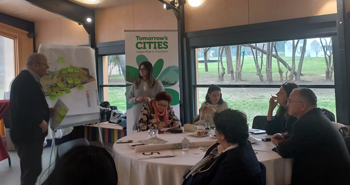
Urban Scenarios are finalised and validated in follow-up workshops where groups gain insights into future trends and the technical assumptions, shaping the future city. Participants are invited to confirm or change technical interpretations. Conversations delve into future trade-offs – how to balance different needs and decisions. Participants approach this through the lens of equity, discussing who benefits and who loses from the decisions aimed at reducing future risk.
Urban Scenarios validation workshop in Dar Es Salaam. Participants presenting their Urban Scenarios and chosen policy priorities.
Urban Scenarios validation workshop in Nablus, Palestine.