
12/05/2025
New Initiative Builds on Lessons from Tomorrow’s Cities to Support Risk-Informed Reconstruction in GazaDr. Thaisa Comelli
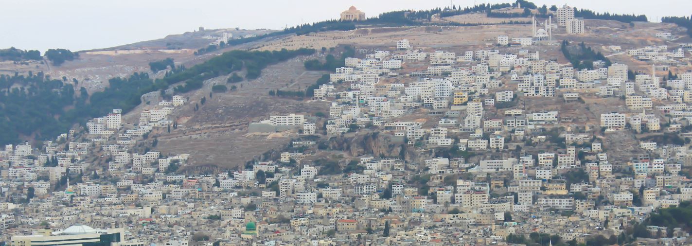
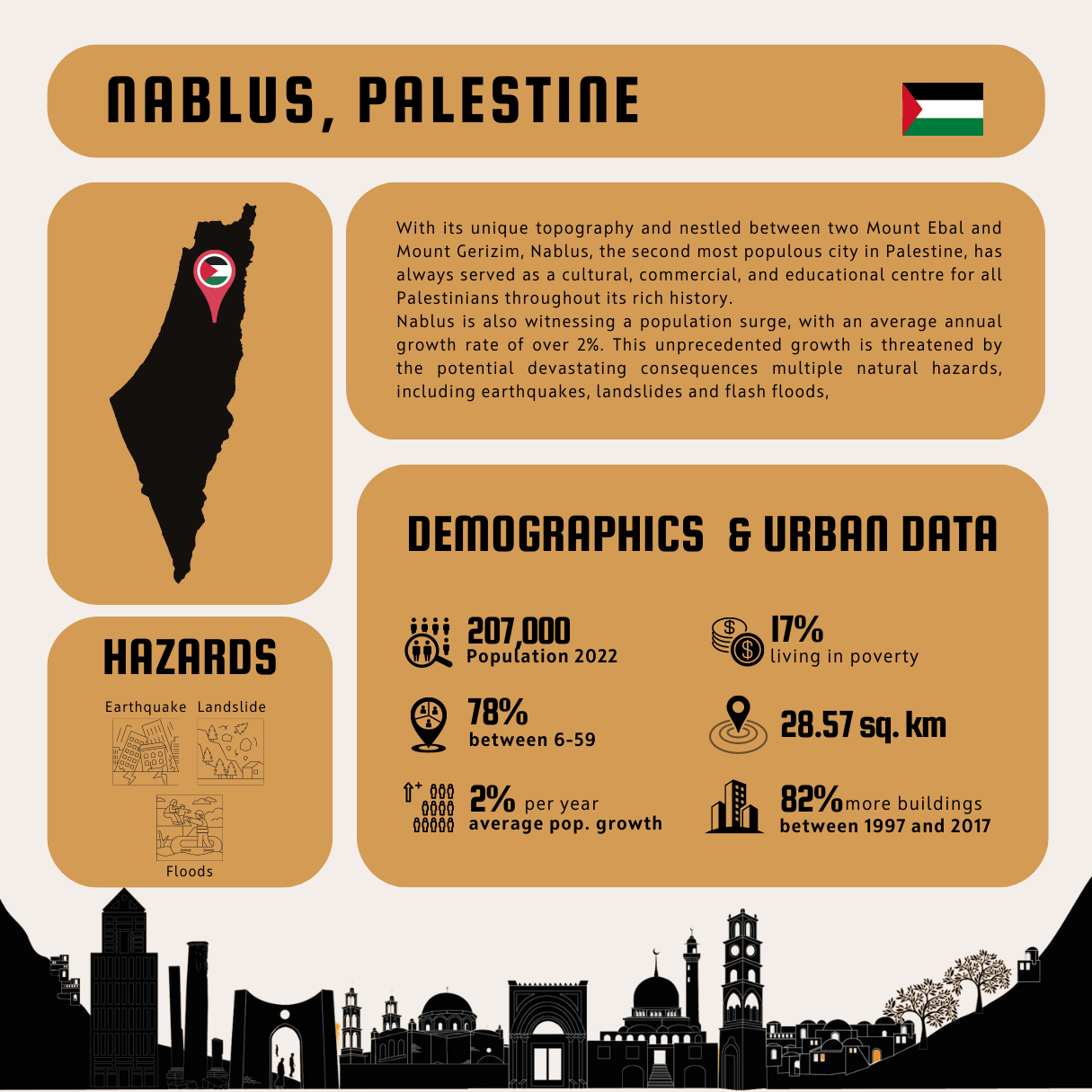
With its unique topography and nestled between Mount Ebal and Mount Gerizim, Nablus, the second largest city in Palestine in terms of population and land area, has always served as a cultural, commercial, and educational centre for all Palestinians throughout its rich history. Despite the significant unrest, economic challenges, and geopolitical constraints, with 45% of its governorate’s territory being under the control of Israel, the city has witnessed an unprecedented rapid growth in the built environment leading to more than 80% increase in the number of buildings between 1997 and 2017. Nablus is also witnessing a population surge, with an average annual growth rate of over 2%. This unprecedented growth is threatened by the potential devastating consequences of multiple natural hazards, including earthquakes, landslides and flash floods, putting the lives of future generations and large groups of vulnerable and marginalised people at risk if no actions are taken by decision makers through a robust risk-sensitive and pro-poor urban planning framework.
Throughout its history, Nablus has been susceptible to multiple natural hazards that pose significant risks to its population and infrastructure, with earthquakes being the most critical due to its immediate vicinity to the active Dead Sea Transform Fault Zone.
In 1927 a devastating ground-shaking event destroyed a large part of the historical city centre of Nablus and caused more than 300 casualties.
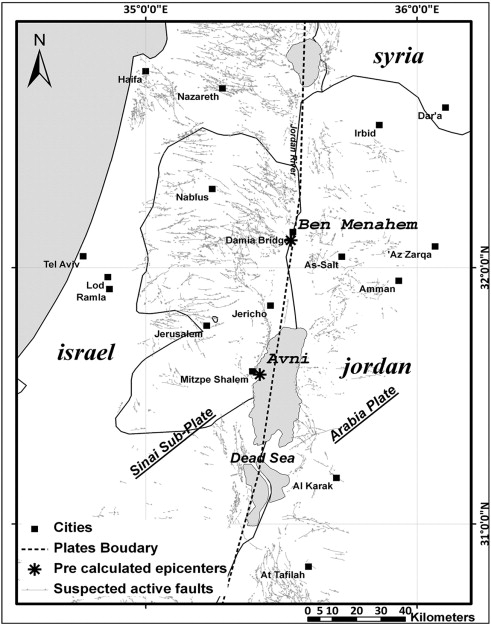 Palestine geological context showing the Dead Sea Fault and estimated earthquake epicentres. Credit: Zohar, M., & Marco, S. (2012).
Earthquakes also trigger landslides, such as the one that took place upon the 1927 Nablus Earthquake, which blocked the flow of Jordan river. Several landslides occurred in the following years, particularly in 1997, 2004, and 2018, which were induced by either ground shaking or rainfall.
In the past few decades more frequent extreme weather conditions in Nablus and the West Bank in general are leading to higher rainfall intensity. This, combined with the interference with the natural infiltration process through unplanned expansion of engineered surfaces, has increased the potential of flash floods in different areas. In January 2013, Palestine was hit by a strong winter storm that brought intense rainfalls in a relatively short duration, which were followed by an unexpected flash flood that affected more than 12,000 people causing damage to their homes and agricultural lands, in addition to destroying 200 houses and displacing more than 650 people. Nablus was amongst the most affected cities in the West Bank.
The city lacks organised urban planning and mainly expands in a spontaneous rather than planned fashion, depending on topography and jurisdiction. The latest approved master urban plan dates back to 2013 and it does not adequately address the real needs in terms of population growth, development, and urbanisation. Moreover, it disregards the inherent risks of natural hazards and the needs of different vulnerable and marginalised social groups in the Palestinian community.
The extent and location of any future expansion/urbanisation is largely limited by the jurisdiction of the Palestinian Authority. In fact, nearly 45% of Nablus governorate land, even some areas inside the city itself, are classified as “C”, indicating that it is not under the control of Palestinians. These constraints make the expansion process restricted and relatively predictable.
Area A – 18% fully controlled by Palestinians.
Area B – 38% partial control by Palestinians.
Area C – 45% full control of Israel.
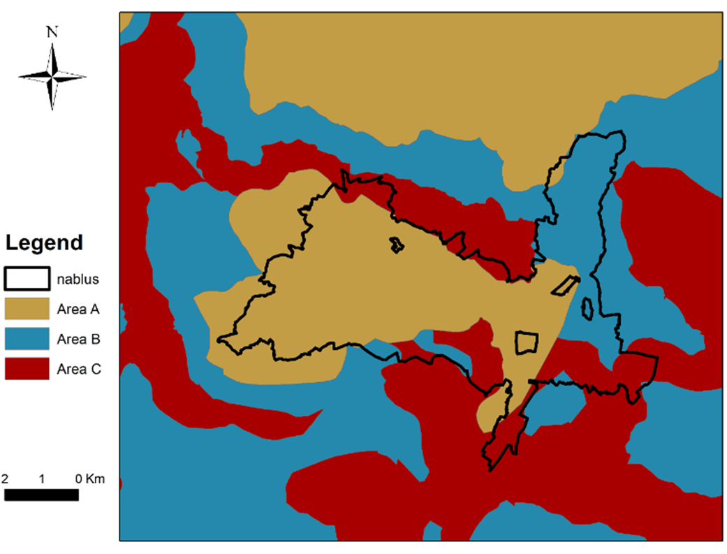 Jurisdiction distribution of Nablus.
Palestinians have been experiencing several restrictions on their economic freedom, mobility, and natural resource control, which represent the main drivers of the high social vulnerability that could hinder the current and future community resilience. Nearly 16% of the population falls under the poverty line and 6% under the deep poverty. 23% of the population belong to age vulnerable groups (under 5 and over 65 years old).
The largest and most prominent socially vulnerability group in Nablus city constitute the Palestinians living in the refugee camps, who continue to suffer very poor conditions such as high unemployment, inadequate healthcare, and large population density. In fact, Nablus is home to three of the largest refugee camps at the entire West Bank level. These refugees represent 32% of the population within the Nablus municipality borders.
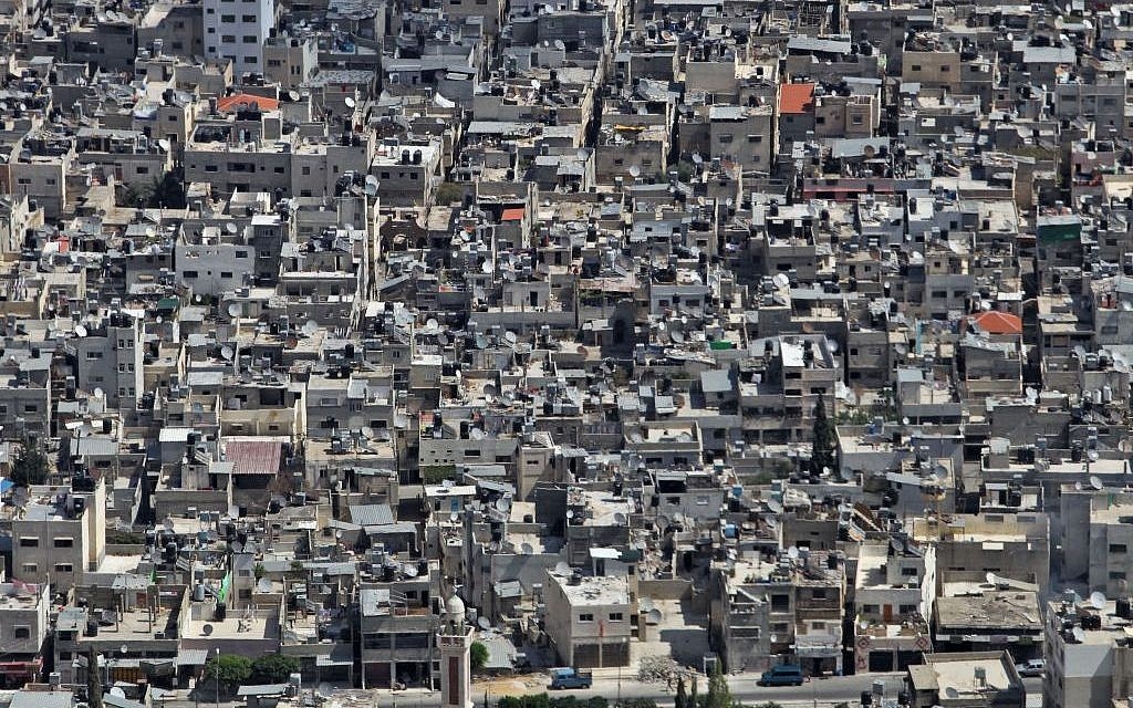 The Balata refugee camp in Nablus is the largest refugee camp in the West Bank, housing some 30 000 people. Credit: Nati Shohat/FLASH90)
Poor construction quality, environmental degradation, and unregulated land use highlight critical gaps in the existing policies, standards, and technical capacities. Despite the recent growing awareness of disaster risk and role of community resilience, which has been demonstrated through enforcing seismic design by the Engineers
Association in 2013 and consequently the government in 2018, the performance of numerous structures (mainly residential) built after these dates is still questionable. This stems from poor construction quality, improper site management, and lack of effective monitoring procedures, which could lead to remarkable differences between design and actual construction, putting the lives of hundreds of thousands under the risk of earthquake damage.
Reduce disaster risk and enhance the resilience for future developments in the city and its neighbouring areas focusing on the needs of the most marginalised and vulnerable groups through risk informed decision making and comprehensive landuse planning.
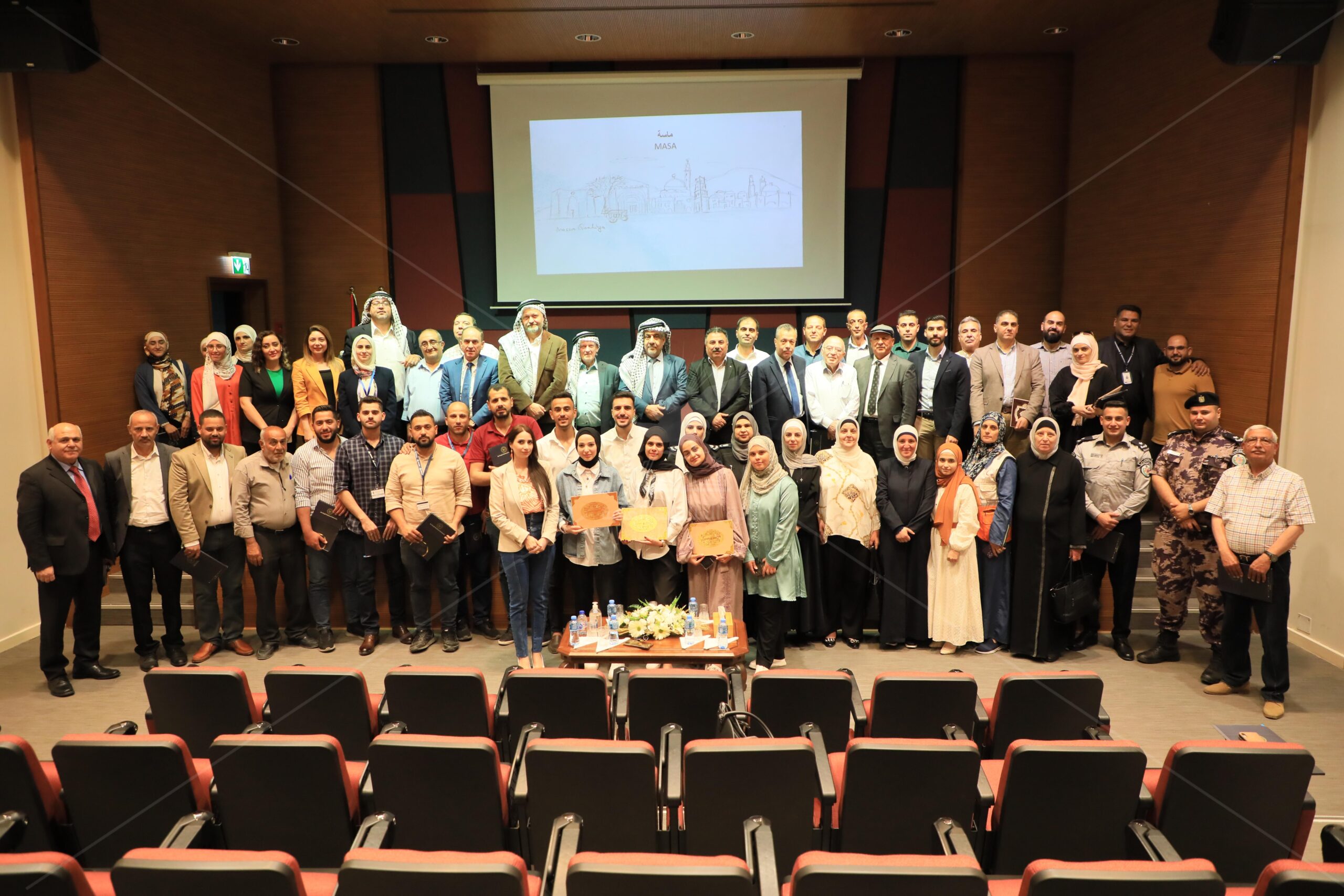
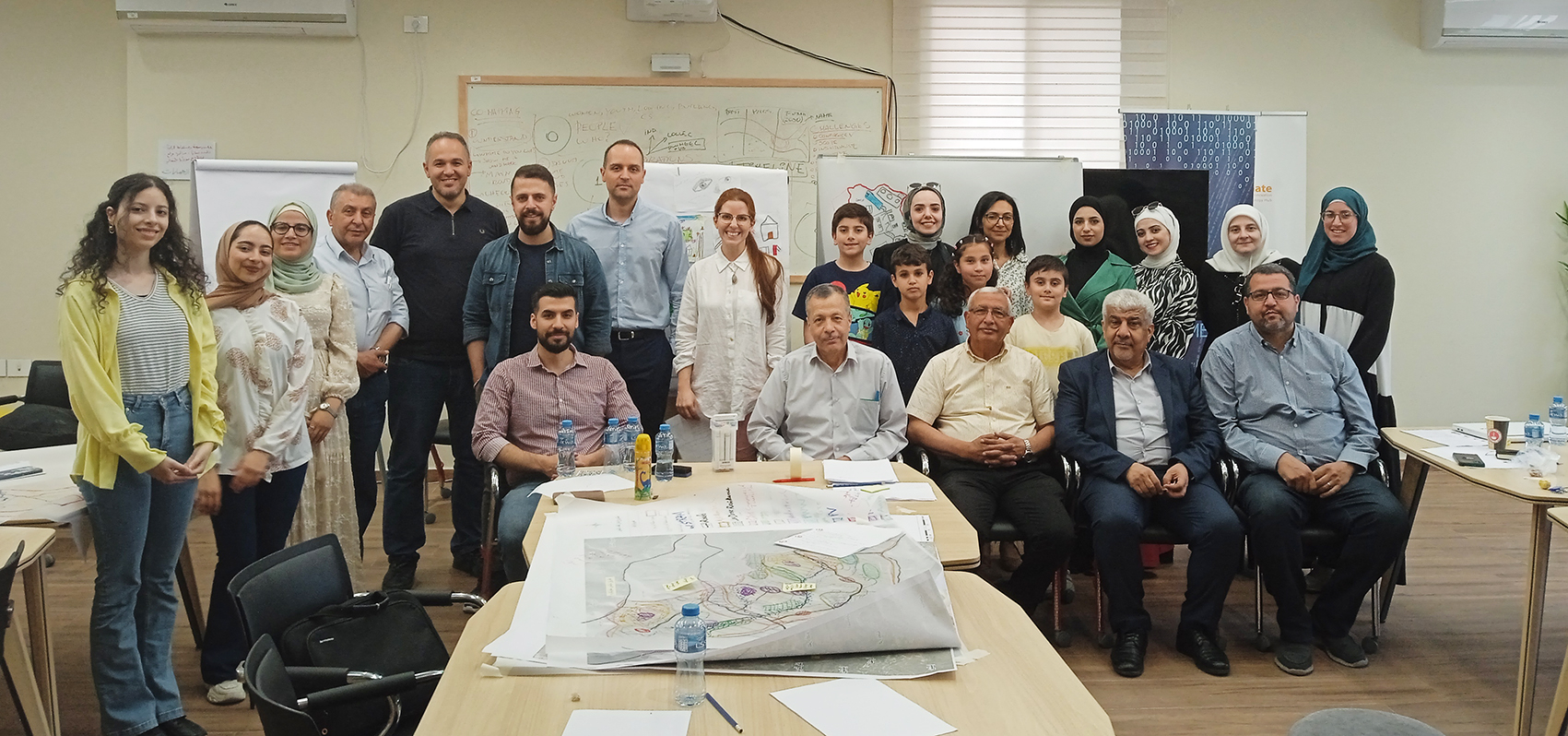
An-Najah National University is leading the work in collaboration with Nablus and Sarra Municipalities and including other key national stakeholders: