- Close
Tomorrow's Chattogram
Summary
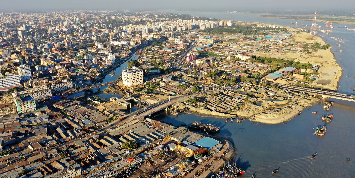
Chattogram is a coastal port city in southeast Bangladesh facing a variety of challenges. Its main threats include cyclones, floods, earthquake and landslides. The city’s population is a mix of different ethnicities and economic activity, making it a vibrant yet complex city. Rapid urban growth has strained the city’s infrastructure and services. This has led to the growth of informal settlements, many of which lack basic amenities. Other challenges include poor waste management, heavy traffic, and environmental degradation. Chattogram’s resilience is essential as it balances economic growth and sustainable urban development to improve the quality of life of its diverse population.
Boirag Union Parishad, Anowara, Chattogram
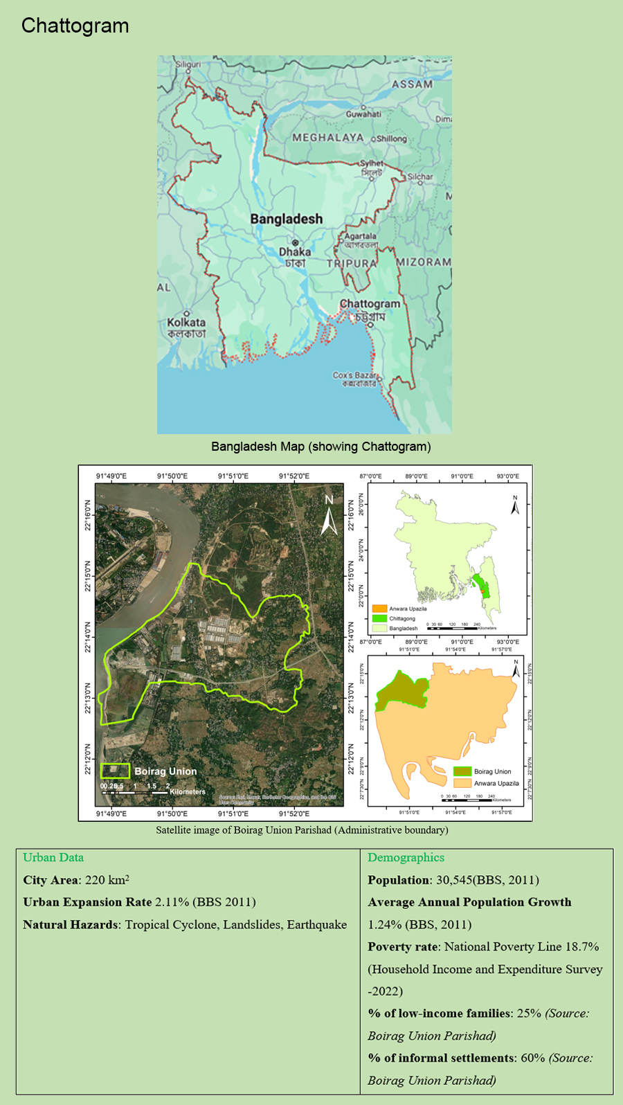
The ‘Boirag’ Union of Anwara upazila is in Chittagong district of Bangladesh. The city place is about 20 kilometer from the Chittagong port city and represents a rural area in Bangladesh (Chowdhury et al., 2015). The union is characterized by its diverse landscape, which includes coastal plains and hilly terrain. It is located at approximately 22° 13′ 46″ N latitude and 91° 50′ 36″ E longitude (Mindat.org), with an estimated terrain elevation of 7 meters above sea level (https://bd.geoview.info/bairag).
Boirag Union spans an area of approximately 20 square kilometers and is comprised of six villages (Bangladesh National Portal, 2022). According to the 2011 census, it was inhabited by a population of 25,546 individuals. The community is diverse, with members representing various ethnic backgrounds, contributing to a rich cultural tapestry. The education rate in Boirag Union, as per the 2001 Education Survey, stands at 40%. This figure reflects the level of educational attainment within the community, indicating areas for potential growth and development.
Boirag has a total land area of 20 km2 having population of 25547 (BBS, 2011). There are two important religious places. It has 6 villages in this union. Moreover, 2 growth centers exist here. The local government comprises of 9 wards which has 12 ward members including 3 female and one union parishad chairman. Boirag has 11 primary schools, 1 high school, 2 madrasas. The literacy rate is 40% (BBS, 2001). Moreover, there exists 1 river (Karnaphuli River Ghat no. 14 & 15).
Chattogram Challenges
-
1. Urban Context and Development Trend
-
The selection of Boirag Union as the study area is driven by the imminent construction of the Bangabandhu Sheikh Mujibur Rahman Tunnel, also known as the Karnaphuli Tunnel. This groundbreaking underwater expressway tunnel, located beneath the Karnaphuli River in the port city of Chittagong, Bangladesh, represents a transformative project. Anticipated to be operational by 2023, this tunnel will significantly enhance connectivity within Chittagong city and its surrounding areas, offering unprecedented transportation options for the region. This development is expected to bring about a surge in economic and social activities within Boirag Union in the near future. Anticipated outcomes include an influx of population, increased demand for housing and services, and a surge in economic opportunities. Given the profound implications of this development, a comprehensive study of the area is imperative to understand and proactively address potential impacts on the local population, environment, and infrastructure.
-
2. Multi-hazard context
-
The climate in Boirag Union is classified as a Tropical Monsoon Climate, according to the Köppen climate classification (Mindat.org). Due to its proximity to the coast, Boirag Union faces potential hazards, particularly from tropical cyclones. These natural events have the potential to cause extensive damage to infrastructure and pose significant threats to livelihoods (Iii et al., 2016.). Additionally, the area’s undulating terrain increases the risk of landslides, especially during periods of heavy rainfall.
-
3. Cyclones
-
Boirag is vulnerable to cyclones, which are strong tropical storms with intense winds and precipitation. Cyclones’ destructive power can do significant harm to the population’s general well-being, agriculture, and industrial infrastructure. According to UNDAC Mission Report Bangladesh: Cyclone – May 1997 conducted by UNDHA, A UN Disaster Assessment Team was sent out following the storm that struck Bangladesh’s southeast and south coast on May 19, 1997. The UN Resident Coordinator in Bangladesh is in charge of general coordination and monitoring of the deployment, which is being carried out in partnership with the Bangladeshi government. The government has provided the UNDAC Team with preliminary data regarding the cyclone’s effects. Government estimates show that the cyclone left 20,000 families impacted, 500 people injured, and 75,000 dwellings completely damaged and 14,700 houses.
-
4. Floods
-
The majority of riverbanks along the Karnafully River are vulnerable to flooding. The region is susceptible to flooding, stemming from either heavy rainfall or cyclone-induced storm surges. Floodwaters pose a significant threat, as they can inundate homes, destroy crops, and contaminate water sources, jeopardising both lives and livelihoods. Specifically, during the period from 26th June to 5th July 2012, an estimated 24,550 families in the Anwara upazila were adversely affected by the floods.
-
5. Landslides
-
The hilly terrain in North side of Boirag is prone to landslides, especially during periods of intense rainfall or seismic activity. Landslides can result in the loss of lives, property, and crucial ecosystems, disrupting the delicate balance of the local environment.
-
6. Earthquakes
-
The region is situated in a seismically active zone, making it vulnerable to earthquakes. The sudden release of energy during an earthquake can lead to widespread destruction of infrastructure, homes, and critical facilities, amplifying the challenges faced by the local population.
-
How can Tomorrow’s Cities help or bring to Chattogram?
-
In this project, the risk and vulnerability maps, along with the hazard maps, will be prepared and consulted with the local people. The inclusion of vulnerable groups in the preparation and finalisation phase will increase the sustainability of the plan. There is a challenge associated with including such groups in the preparation phase but the local government development authorities can help in organising the required meetings.
The outputs and outcomes of the engagement with Tomorrow’s Cities are as follows:
- Capacity development on decision making risk reduction on future cities planning both in public and private sector.
- Capacity development on different hazards and its impact assessment through training and workshop.
- Empowerment of the citizens, stakeholders and beneficiaries in the decision making.
- Hazardless mapping of considered area that could be implemented in the Master Plan preparation.
- International collaboration and future research work on similar works on other cities of Bangladesh and other underdeveloped countries.
- Multi-hazard vulnerability and risk assessment of the considered area.
The following groups are responsible for continuing the work of Tomorrow’s Cities after the International teams leave the city.
The CDA team
The CoxDA team
The CUET team
The DU team
-
Main stakeholders
-
Chattogram City Development Authority
Chattogram City Corporation
Chattogram Water Supply and Sewerage Authority
Chittagong University of Engineering & Technology
University of Dhaka
Social Links