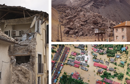
In this video Gemma Cremen, Lecturer in Risk and Resilience Engineering at UCL explains how current approaches to risk-modelling are limited as they typically focus on existing hazard, exposure and vulnerability; measure impact in terms of financial losses related to physical infrastructure and fail to account for the interdependent physical and social systems that underpin a city.

During the Hazard & Impact Modelling stage, the scenarios created during the Urban Scenarios stage are subjected to physics-based computer simulations of single and/or multi-hazards.
These simulations produce a set of Impact Metrics that characterise the consequences of those hazards on the physical and social fabric of each urban scenario. For instance, data such as the number of casualties, injuries, displacements and economic costs, but also the effect of the hazard events on individuals from a given socioeconomic group.
The process starts with identifying the pertinent natural hazards through historical records, stakeholder engagement (Future Visioning workshops), field surveys and other sources. This information is then combined with data on the physical built-environment (from the Urban Scenarios stage) and maps of severity/intensity calculated for each hazard or multi-hazard scenario (see below) and used in physics-based simulations that assess the impact of hazards to the forthcoming built environment (buildings and other infrastructure).

Computed Impact Metrics for Visioning Scenario 1

Computed Impact Metrics for Visioning Scenario 2

Computed Impact Metrics for Visioning Scenario 3
Using the social data gathered during earlier stages of the TCDSE, which includes demographic and socioeconomic information on individuals, mobility trends, and the spatial distribution of social infrastructure dependency within the urban area, Tomorrow’s Cities Social Impact Module also assesses and categorizes the impacts of upcoming multi-hazard scenarios on different social groups that inhabit the city, particularly the most marginalised.
Ultimately, the process concludes by producing a set of Impact Metrics that capture the societal repercussions of hazards. These metrics encompass factors like the count of displaced individuals, children lacking educational access, unemployed individuals, and those deprived of healthcare accessibility. They are used to assess and compare Visioning Scenarios within a democratized risk agreement process..

This phase of the TCDSE directly overcomes the restrictions of traditional approaches to quantifying natural-hazard risks that primarily concentrate on direct economic losses arising from physical destruction. It acknowledges that: (a) the impact of $1 in losses resulting from direct physical damage is not uniform across diverse income groups; and (b) numerous other factors, such as age, gender, disability, homelessness, sexual orientation and identity, and membership of indigenous groups, determine how calamities affect specific individuals or communities.

Gemma Cremen

Modelling the effect of hydraulic conductivity variability on slope stability calculations for a site in South-East Quito, Ecuador
Rainfall-triggered landslides are increasingly a concern in rapidly urbanising areas around the globe.


