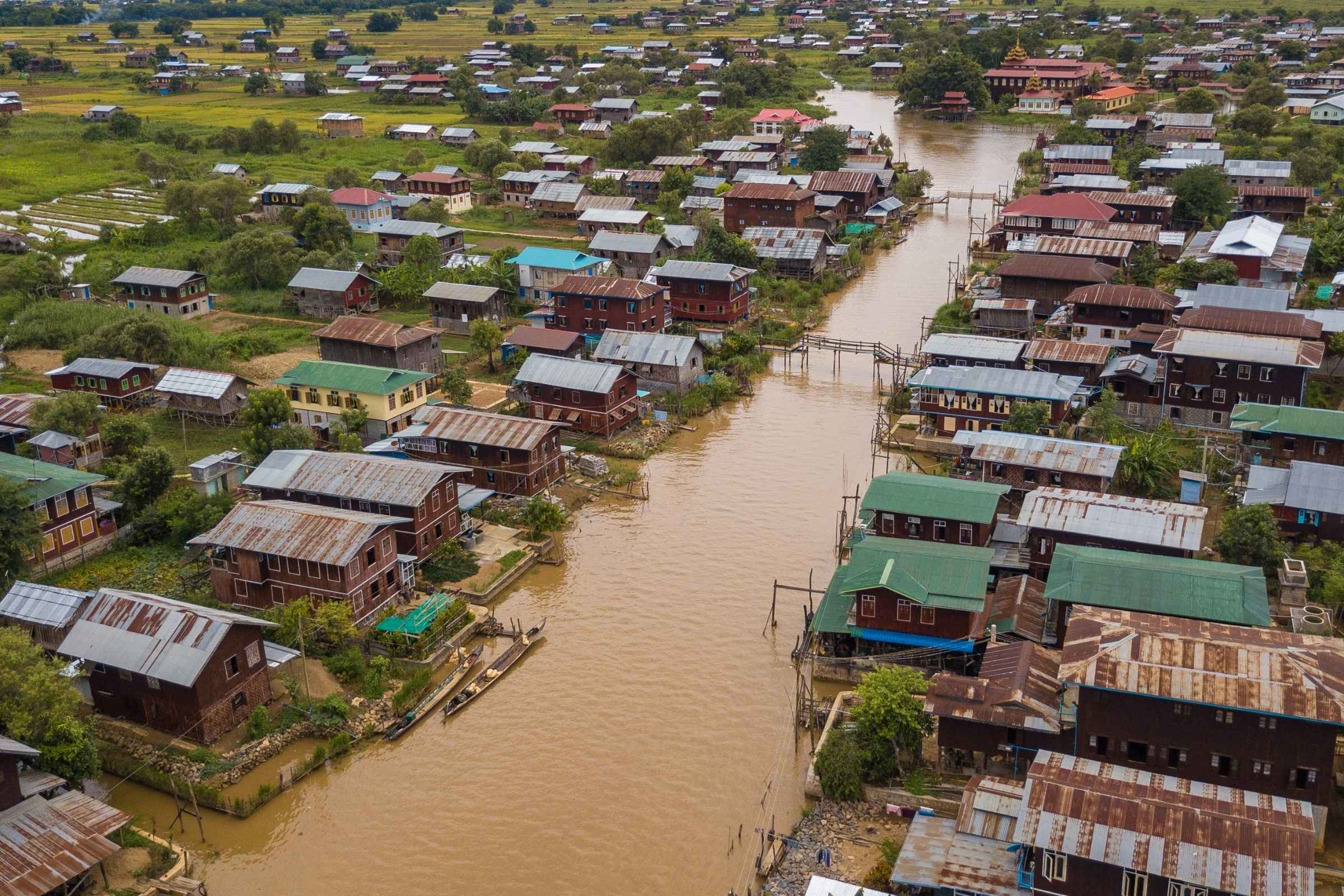
Floods are the most frequent cause of disaster and a hazard that disproportionally affects the poorest communities. Credit: Tony Wu
As developing cities grow, so does the exposure to a multitude of natural hazards such as floods. These are especially problematic for informal settlements. What is needed therefore is an adaptable approach to urban flood risk management in developing cities. With that challenge in mid, Tomorrow’s Cities researchers in Nairobi have developed an integrated methodology that allows for the understanding of evolving flood risks at various city scales.
In Kenya, two rainy seasons mark the annual calendar. The “long-rains”, which usually occur between March and May and are frequently characterised by bursts of torrential rainfall, are the most important period in the country’s farming calendar. These long rains are often the cause of disasters, as occurred in 2018 with grave humanitarian consequences. That year, the long-rains season was one of the wettest on record causing the displacement of over 300 000 people across Kenya and over 132 deadly victims (data from the United Nations Office for the Coordination of Humanitarian Affairs). Unfortunately, major flood events are a familiar sight in Kenya, with data showing at least 17 major floods since the 1960s.
Despite less serious, short rains (October to December) occasionally present devastating flooding impacts in Nairobi, especially in the informal settlements.
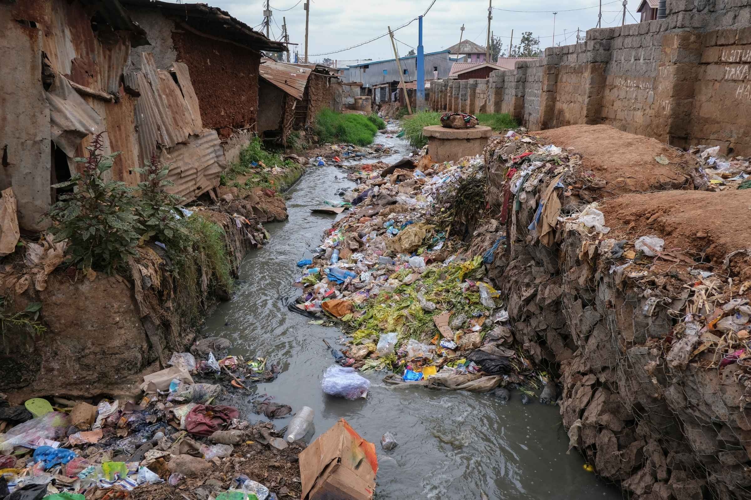
In the Kibera informal settlement in Nairobi more than 22000 residents live along the riverbanks of the Ngong River. Lack of appropriate infrastructure leads to waste being often disposed to water courses causing blockage and amplifying the effects of floods. Credit: Getty Images
As with other natural hazard threats, the impact of these disasters is greater in the poorest communities such as those in the Mukuru, Kibera and Mathare Kosovo informal settlements. With the rapid growth of these communities, together with the impacts of climate change, the future seems troublesome. To change that, researchers from the African Centre for Technology Studies, the University of Nairobi and the Africa Research and Impact Network, working in the Tomorrow’s Cities project are proposing a different approach to flood management with an emphasis on the informal settlements of developing cities.
Understanding flood risk at various city scales for an integrated city flood risk management
Flooding occurs when water overflows onto an area that is normally dry land as a result of heavy rainfall, storm surges or melting snow and ice. They are by far the most frequent cause of disaster accounting for over 3200 occurrences (44%) and more than 1.6 billion people affected between 2000 and 2019. In 2021 alone, more than 50 severe flood events around the world caused combined economic losses of US$82 billion.
In the research paper published on the Journal of Hydrology, The Tomorrow’s Cities Nairobi team, highlight that, while flooding can occur in both rural and urban settings, its occurrence in an urban context has a unique nature. In cities, beyond the natural phenomena, it is the built environment - the man-made infrastructures such as buildings, the water and electricity distribution systems, roads, bridges, and other transportation systems – and the high population density that play an important role in the way floods unfold. To help city authorities plan and design risk management policies, researchers employ computational simulation methods to understand the current flood risk and predict future floods under different scenarios. However, in developing cities such as Nairobi where a large number of informal settlements exist, flood modelling is more complex as these communities are often built on flood plains and waterways and are not equipped with appropriate drainage systems.
“We noticed that few flood hazard modelling studies exist for informal settlements in Africa. This has led to inadequate or even absent risk management measures and policies for these specific urban areas, leaving the urban poor forgotten and at greater risk”,
Tom Randa, African Centre for Technology Studies, leading author of the study.
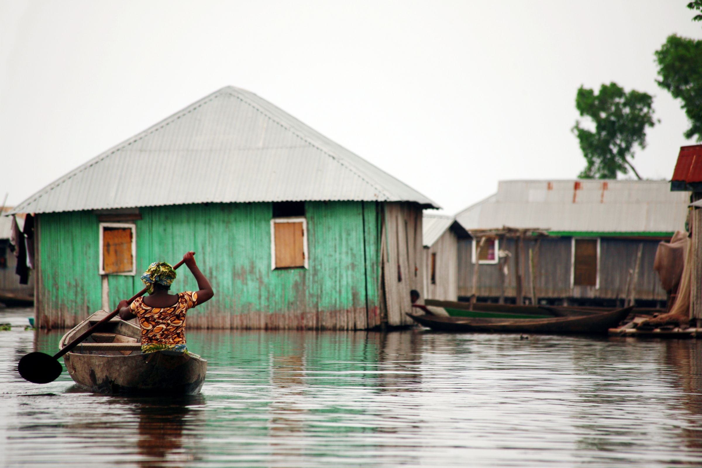
Woman is forced to use a canoe to move in flood waters. Credit: Getty images
Using Nairobi as a case study, Randa and his colleagues took a systematic literature review of the most recent research and modelling techniques aiming to capture the urban flood models that can be applied in developing cities.
“In the Kibera slum, more than 22000 residents live along the riverbanks of the Ngong River which meanders through the city. Most of them reported that their homes have been flooded in the recent past since 2015. The literature also shows that areas where flooding was rather infrequent two decades ago are now suffering more flooding events.” explains Randa, justifying why this issue needs to be addressed urgently.
On their review of the scientific research done to date, the team found several flood modelling studies conducted in Nairobi. They reveal that the city is at high risk of flooding as a consequence of urban densification, inadequate city drainage network, and continually changing urban hydrology. They also found studies demonstrating that in informal settlements such as Kibera, it is crucial to engage the local community in participatory processes along with the use of analytical methods.
With that in mind, Tomorrow’s Cities is working with local authorities in the implementation of the Mukuru Special Planning Area (SPA), one of the largest ever informal settlement upgrading projects, to transform one of the largest 'slum' areas of Nairobi – 650 acres and 138,000 homes, businesses, and other institutions – into a healthy, functioning neighbourhood.
“We are exploring the integration of physical science modelling, social science understanding, and community participation in flood risk management in the implementation of the Mukuru SPA”, says Randa.
Using the Mukuru SPA case as an example, the researchers conclude that it is possible to implement flood risk management policies that consider informal settlements if simulation models are calibrated to specific local realities and if several modelling algorithms are used in a process known as “model stacking”, where the results of one model are used in the next model to optimize the simulations. They also advocate for participatory and inclusive practices to address the local vulnerabilities associated with flood risks.
Read the research paper.
Informal Settlements
Informal settlements refer to areas of unplanned urbanisation where housing does not comply with the current housing codes and regulations. These areas are characterised by a lack of legal settlement and housing plan approvals resulting in poor physical infrastructures and social services.
As not all informal settlements are slums or shanty towns, the term "informal housing" is able to capture the informal population who does not live in that type of settlement. UN-Habitat defines slum housing as lacking at least one of the following criteria: durability, sufficient living space, safe and accessible water, adequate sanitation, and security of tenure.
In Nairobi, the nearly 200 informal settlements are home to approximately 2.5 million, representing 60% of the city’s population and occupying just 6% of the land.